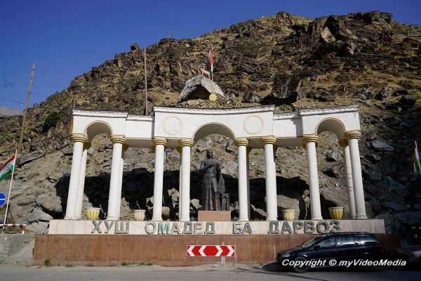
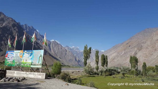
Kalaikhum lies approximately half way from Dushanbe to Khorog, at an altitude of about 1200 m.
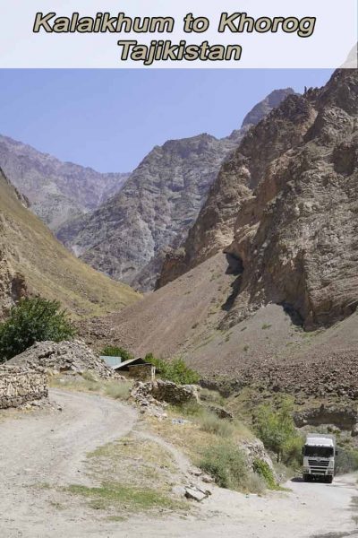
The road from Kalaikhum to Khorog is part of the original Pamir Highway and the distance is only 242 km. Although we only make few stops and a short lunch break, we need a total of 9 hours. The road is in poor condition and we can only move at low speeds. Up to Khorog, the road climbs to an altitude of 2000 m. The surrounding mountains are up to 4500 m high.
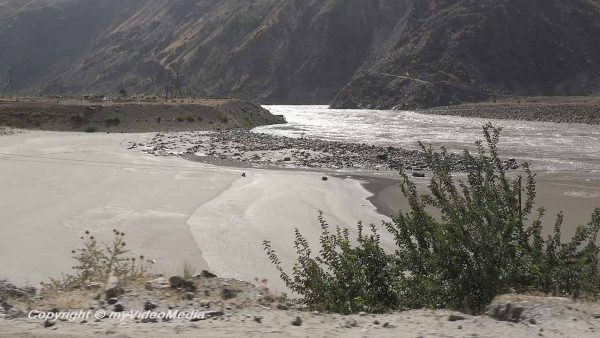
Since we arrived in Kalaikhum at dark, we take a short walk in the morning to look around. The village is at the muzzle of a little river into the Panj River, the most important river in the region. The opposite bank is already part of the national territory of Afghanistan.
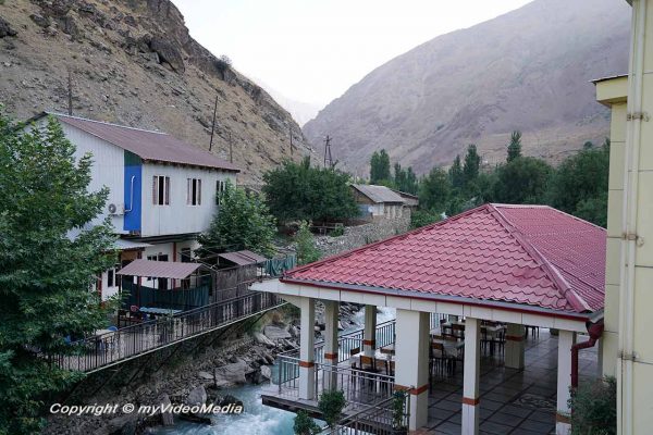
We spent the night in a small apartment right by the bridge over the small river. There are two toilets for multiple apartments, but we have a private bathroom in our apartment. Our place was much better than the one of our fellow travelers who have to share a toilet and a shower (a hose) with about 20 people.
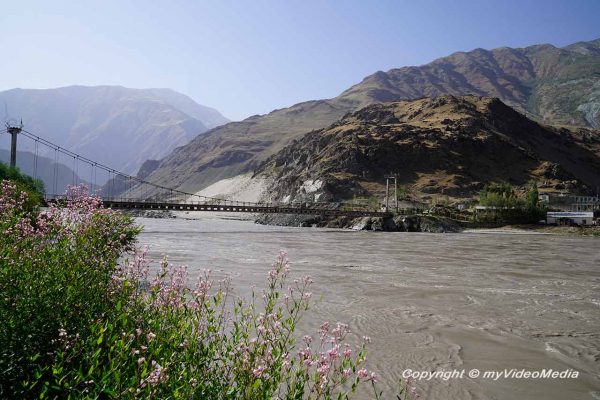
Shortly after leaving Kalaikhum, we make a short stop near a bridge to Afghanistan. The drivers have to fill up the tanks. We use the time to look at the landscape. A nearby landslide makes it clear how dangerous it can be here, especially in spring, when the ice melts and the soil lose its grip. But we do not have a long time to give ourselves to such thoughts.
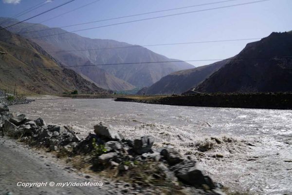
We drive along the Panj River, which meanders between the mountains. It is always exciting when several trucks are in front of us or approach us. The drivers of the trucks have an extremely difficult job.
Please watch the 4K UHD video – Part1
You are currently viewing a placeholder content from YouTube. To access the actual content, click the button below. Please note that doing so will share data with third-party providers.
More InformationAs a rule, they are on their own, even if they try to ride with another driver, at least in parts, in a convoy, to be able to help each other when necessary.
Anyway, it’s an exciting ride that never gets boring. The landscape changes constantly and shows itself from a new side. The vegetation is already a bit sparse due to the altitude. On one turn of the Pandj River is a beautiful huge sandbank, which invites you to sunbathe. But only a few cattle take the opportunity.
While the road on the Tajik side is in a relatively “good” condition, there is usually only a narrow path along the Pandj River on the Afghan side. Mostly it is only roughly hewn out of the rock, but partly not yet finished. This is probably the only connection to the outside world for the picturesque villages.
Colored bouquets of flowers fairly often decorate the roadside. They are in memory of the relatives, who were killed in an accident.
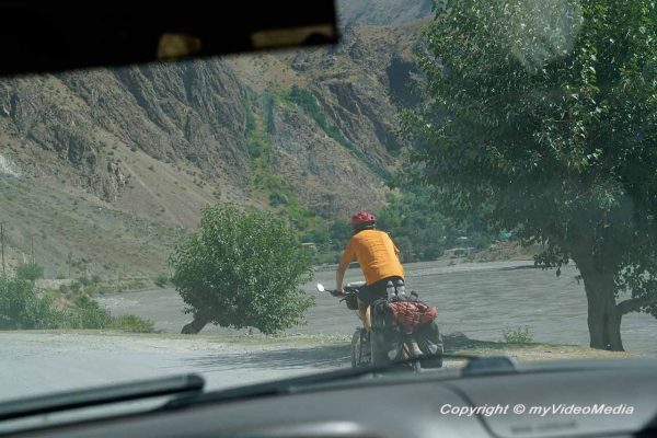
Admirable are the cyclists who conquer the Pamir Highway by bicycle.
Shortly before Poshkharv, we stop briefly to capture the beautiful view of the landscape. I walk away a bit from the group because I want to film both the Pandj River and the village opposite. Suddenly our guide Sherali comes running and shouts that I should not film. When I look up surprised, I can already see from the corner of my eye two soldiers with rifles shouldered. They do not make you feel like you can talk to them nicely.
So I pack my tripod and Sherali tells them that I did not film anything. They are satisfied with that, although I still do not realize what was here, what should not be filmed. Probably the soldiers themselves.
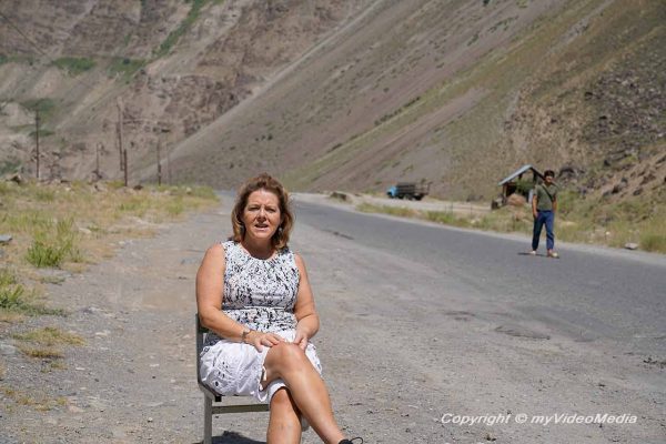
Meanwhile, our friend Eithne made herself comfortable in the middle of the street.
We drive on to Lyakhsh and make a short stop again and eat something. Here one quarries the white marble, which is in great demand.
Not only the high mountains fascinate in this landscape, but also the Panj river. It is sometimes pressed through bottlenecks, where the water flows at high speed, raising the spray. Shortly thereafter, the riverbed widens again and creates the impression of a lake. Here, the water is usually very calm and almost seems to stand. Sometimes small islands form, between which the Panj River meanders down the valley.
After another hour, we want to stop at a popular cafe, but unfortunately, all tables are occupied, so we decide to continue our way.
The valley widens near Rushan and the Bartang river flows into the Pandj river. We cross the Bartang on a long bridge. The Batang originates in the Sarez Lake. The lake arose by a huge landslide, on 18 February 1911. This formed the highest natural dam with a height of 576 m. The dam is considered so unstable that the region around the lake may be entered only with a special government permission. If the dam breaks, it would cause a 150 to 170 m high tidal wave, which would hit the Panj river here at Rushan and spread to Uzbekistan and Turkmenistan. 5 million people would be affected by this catastrophe.
Please watch the 4K UHD video – Part2
You are currently viewing a placeholder content from YouTube. To access the actual content, click the button below. Please note that doing so will share data with third-party providers.
More InformationWe drive through some larger villages before a flat tire of one of the cars makes us stop in the open field shortly before Khorog. But our drivers are true professionals.
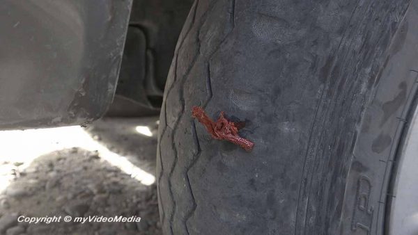
In no time, they seal the hole in the tire with a piece of animal skin and inflate the tire with an electric pump, connected via the battery.
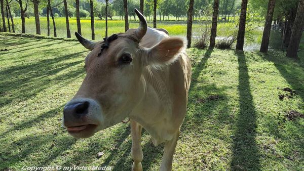
We pass the time with a short conversation with a cow grazing here. 15 minutes later, we are back on the road and soon reach Khorog, our destination of today.
Please read on> Botanical Garden in Khorog
Pin it for later
Text, photos and video: Copyright © myVideoMedia