Kyzylart Pass
At the top of the Kyzylart Pass at 4280 m above sea level, we leave Tajikistan and enter Kyrgyzstan. We have already left the border control behind us. We are on the way from Kara Kul, a lake in eastern Tajikistan to Osh in Kyrgyzstan. But before that, we want to explore the Base Camp at Mount Lenin. So we have planned an overnight stay in Sary-Mogol.
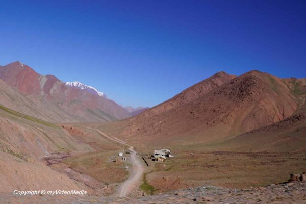
The road from Kara Kul to the Kyzylart Pass runs through a high valley and rises relatively flat. But in the north, the road winds all the more steeply to the valley. Only when the road turns into the valley of the Atjaylo it becomes better and rather flat. Until then it is a piste of stones and clay.
Please watch the 4K UHD video
You are currently viewing a placeholder content from YouTube. To access the actual content, click the button below. Please note that doing so will share data with third-party providers.
More InformationThere are no bridges, so the driver has to drive through the small creeks. Here, the Pamir Highway is less frequented, as most trucks go directly from China via the Kulma Pass to Murghob and continue from there to Chorugh.
Sary-Tash
We cross the Trans-Alay Range with its mighty mountains, over 7000 m high. The more the valley widens, the better we see the Trans-Alay Range, and the mightier the mountains appear.
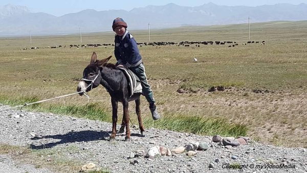
The meadows are becoming increasingly dark green. You see scattered yurts and in between many horses and goat herds. Children have stretched a string across the street and demand toll to pass. Our driver gives them some dried apricots, whereupon they happily open the road.
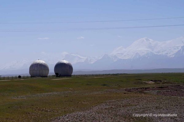
From a distance, we see two spherical buildings near Sary-Tash. It is a well-known monitoring and listening post of the Soviets. At that time, the fear towards the Chinese was big. Today it serves as a training center.
Sary-Tash lies at a crossroads between the Pamir Highway from Morghab to Osh and the West-East connection from Dushanbe to China through the Alay Valley with the Kyzyl-Suu River. This river, with its rust-brown color, meanders through the wide valley.

The village offers some overnight accommodations, small restaurants, and a gas station. A garrison of Tajik border guards in Sary-Tash has the task to stem the drug traffic.
Sary-Mogol
We continue towards the west and reach Sary-Mogol after about 35 km. The place is famous for its coal mines, which supply the region with fuel. On the way to Osh, we will later see many trucks transporting the coal.

At the moment, the hay harvest is everywhere brought in throughout the region to ensure surviving the animals in severe, snow-rich winters.

We have a Homestay with space for 10 people. There are a shower and a toilet. The catch here is that both only works, if the current is available, otherwise the water pumps do not work. And there is electricity only in the evening hours.

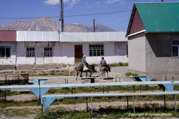
Our friend Eithne Treanor has immediately made friends with the younger generation
In the town is even a bank branch with a cash dispenser. Unfortunately, it accepts only local credit cards. In front of the bench are a mare and her foal. The mare has a crippled leg. and also a wound, as many flies settle on it.
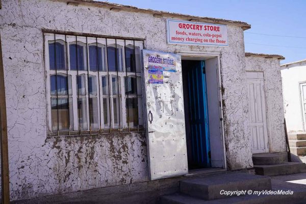
A small morning walk shows us that there is also a market from time to time. Otherwise, the people have to buy in two relatively sparsely equipped groceries. Furthermore, you find a mosque and a community center for events which will open soon.
Two men welcome Eithne on the street, they have already enjoyed some alcohol. One of the two takes me immediately to show me his house. When Eithne appears, they invite us for a cup of tea.
Even if some things took a lot of getting used to, the view from Sary-Mogol to Lenin’s peak is phenomenal.
Pin it for later

Please read on > Visiting Lenin Peak Base Camp