The Burana Tower is located about 12 km southwest of the city of Tokmok in the valley of the Chu river. The tower was built in the 10th or 11th century. Its original height was 40 meters. Today, its height is 21.7m. The upper part was destroyed by an earthquake.
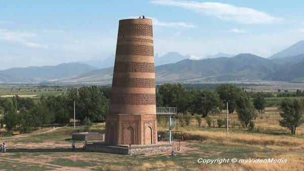
Upon arrival on the site, we only notice the massive tower, which has a diameter of almost 10 m at the base.
The tower gets a high significance if one knows that here used to be a town on an area of 20 to 30 km ², as excavations testify. Presumably, it was the city of Balasagun. Balasagun was founded by the Sogdiern who had its roots in Iran. It was first mentioned in 942. Shortly thereafter, the city was conquered by the Turkish Karachanids and declared the capital of the empire.

When the empire was divided in the mid-11th century, the city was so weakened that it could be conquered easily by the Mongol Kara-Khitan Khanate. In 1211, the son of the former leader of the Naimans came to power but was in conflict with Genghis Khan. Thus, in 1217 the Mongols of Genghis Khan took over the city, which afterward fell into oblivion.
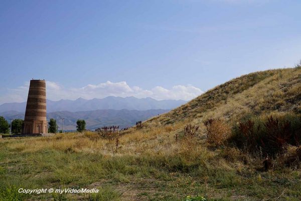
Today, the municipal area which was surrounded by a double wall can still be recognized. A hill, which originally was a citadel is west of the Burana Tower. The name Burana derived from the Turkish word Murana and means minaret.
The minaret is the oldest in Central Asia. There is a similar tower in Ösgön which, also had guard functions. One may suspect similar functions here since the entrance is located at a height of 7 m. In the case of an attack, it was easier to defend.
During the excavations, one also found the remains of religious buildings, such as a mosque and many mausoleums.

A lot of petroglyphs and Balbals (little gravestones) are exhibited in the northern part of the area. One has brought them here from the entire Chu Valley.

A small museum displays artifacts found during excavations. Also, many historical photos and illustrations of reconstructions are on display.
Please watch the 4K UHD video
You are currently viewing a placeholder content from YouTube. To access the actual content, click the button below. Please note that doing so will share data with third-party providers.
More InformationWe also take the opportunity to make a small flight with a drone to get an overview of the terrain. Above all, the remains of the excavations are easy to recognize from the air. Unfortunately, the weather is a bit hazy, so that the huge mountain range of the Kyrgyz mountains in the background only partially stands out.
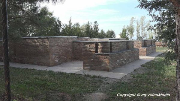
When leaving the grounds we still see the bases of two mausoleums, which have been reconstructed here.
Please read on> From Burana Tower to Almaluu Yurt Camp
Pin it for later

Disclosure: Our trip was organized in cooperation with Discover Kyrgyzstan, and made possible by the support of the United States Agency for International Development (USAID). All opinions are our own.